在工作中我们可能会遇到一些需求,需要某些特定的地图,并且在地图上要加一些特殊的标记.
获取指定区域的地图
https://datav.aliyun.com/tools/atlas/index.html
可以选择指定区域的地图,精确到区,这个网站的geo数据更新比较及时,21年杭州区划变更以后,数据也得到了更新.
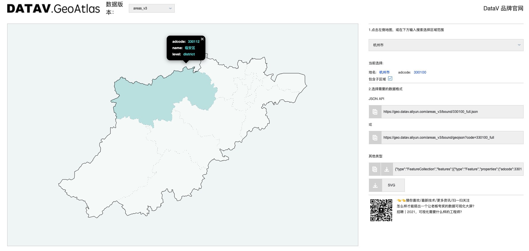
复制对应的 json数据.
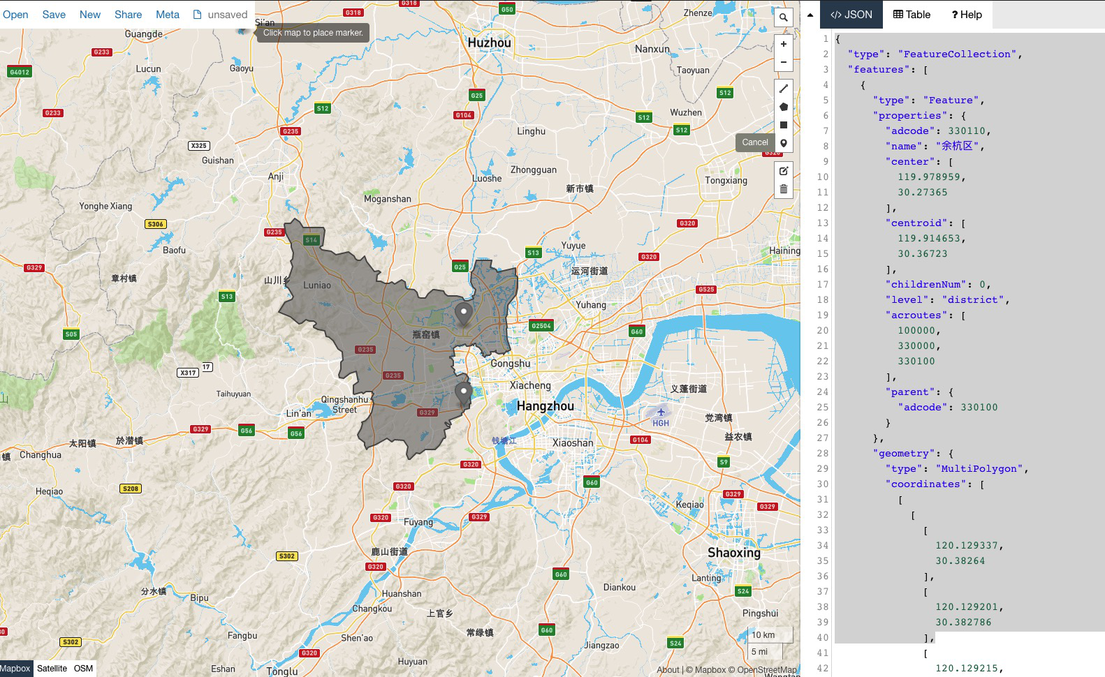
格式类似如下:
1 | { |
画点
复制json数据到geojson.io,
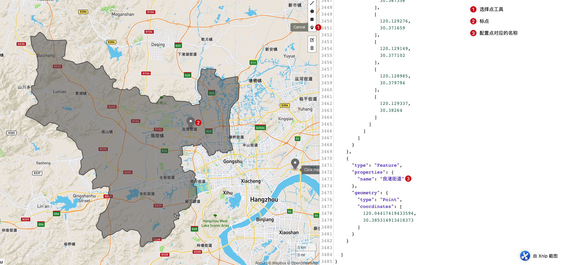
最后把修改后的json复制保存,到echart或者datav等实用即可.
在工作中我们可能会遇到一些需求,需要某些特定的地图,并且在地图上要加一些特殊的标记.
https://datav.aliyun.com/tools/atlas/index.html
可以选择指定区域的地图,精确到区,这个网站的geo数据更新比较及时,21年杭州区划变更以后,数据也得到了更新.
复制对应的 json数据.
格式类似如下:
1 | { |
复制json数据到geojson.io,
最后把修改后的json复制保存,到echart或者datav等实用即可.